
Trail Conditions
Blue Hills Trail CONDITIONS
HINT: Reload this page to make sure you have the latest info.
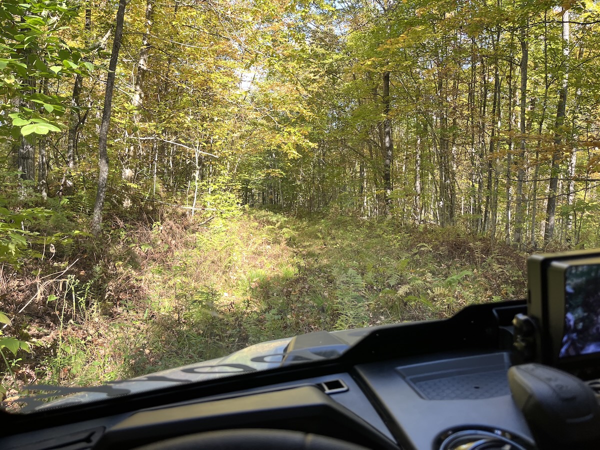
Good hiking conditions, especially on the mowed trails (see below). Unmowed trails have tall grasses (knee high or taller).
Insect activity is mild-moderate. Anticipate some nasty deer flies; ticks were numerous earlier this summer.
IMPORTANT UPDATES
snowfall
May 7: scant flurries
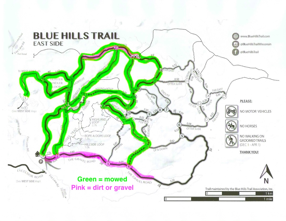
grooming & MOWING
Mowing Report / Plans:
Mowing of the East Side trails began June 27th - look at the mowing map (below). The Rusk County Forestry Department usually mows the West Side trails in late August or September.
Most recent mowing was July 29th - check back for updates.
weather forecast

Trail work
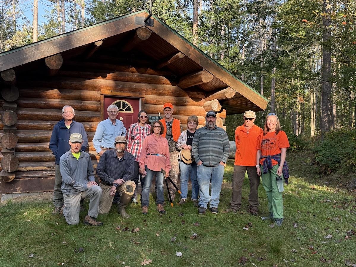
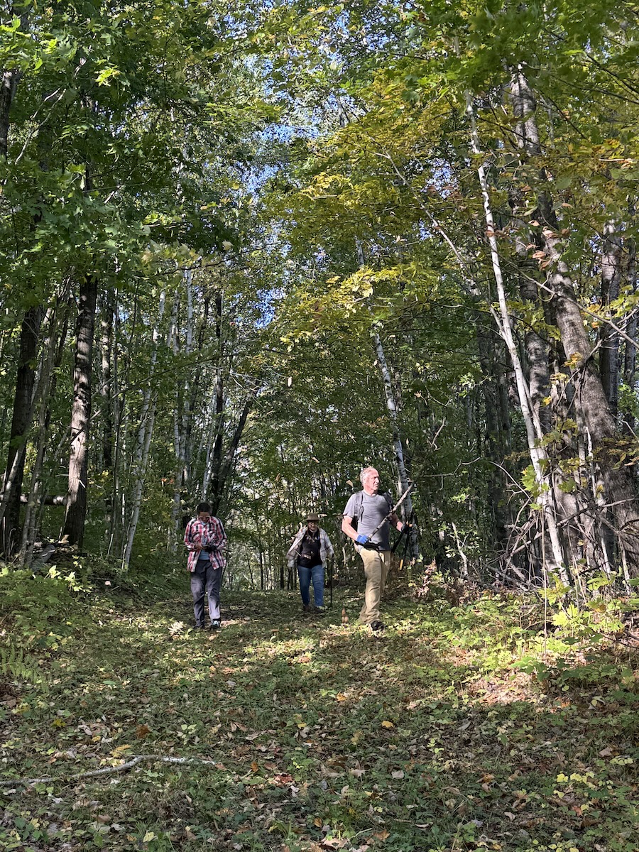
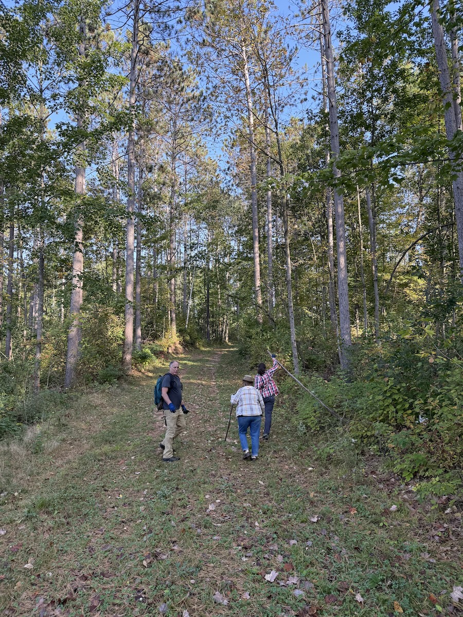
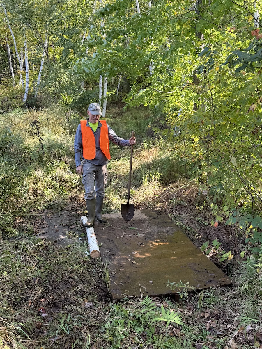
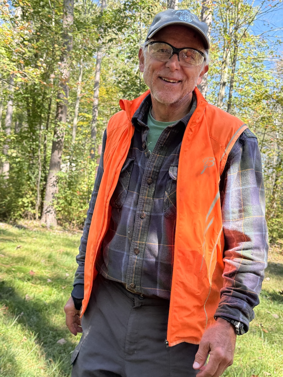
Thanks to everybody that helped during our annual Work Day on September 27th!
Here's a list of our eager volunteers : Heidi A, Rose A, Carolyn C, Dominic H, Jan P, Tom P, Geary S, Bob L, Bill R, John W, Kevin W, Amanda W, Bob W, and John Z.
We enjoyed gorgeous weather and good fall colors as we picked rocks, threw branches, removed logs -- generally getting the trails ready for our favorite time of the year: winter x-country skiing! We probably totaled about 50 human-hours of labor and camaraderie.
If you weren't able to help on the designated work day, we have some leftovers for you. When out hiking this fall -- feel free to throw a few rocks off the trail, perhaps clip some encroaching branches, and remove new windfalls. Please contact our website if you find tree falls that need chainsaw removal.
After the December 2022 ice storm brought down an incredible number of trees throughout our 20+ miles of trails, spring of 2023 our officers weren't confident we'd be able to remove all the damage before the winter of 2023-24. At best, we hoped to clear the damage from our favorite trails. But guess what? As of September 1st 2023, 100% of the trail system has been cleared of downed and leaning trees. Amazing! Amazing!! Amazing!!!
Here's a time capsule of the removal of the storm damage...
- Late December we spent close to $7500 when we rented and operated heavy equipment (backhoe and skidsteer) to clear about 40% of the East Side Trails. Good skiing followed.
- Early January the Rusk Forestry Department contracted removal of downed trees from Excelsior Road on the West Side. And we thoroughly enjoyed skiing that segment.
- January/February BHTA volunteers (Blue Hills Trail Assn) spent several days clearing a few important trails on the East Side. Really tough work removing ice encrusted tree tops buried in 2+ feet of snow.
- We enjoyed some mighty fine skiing on the open trails -- and enjoyed the overall record snowfall and winter that wouldn't quit.
- In May, our volunteers provided 4 separate sessions of tree removal that buoyed our spirits. Then the bugs moved in.
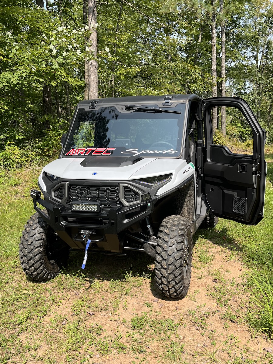
- During June/July/August, we hired an affordable work crew from the Flambeau Correctional Center to clear most of the West Side trails, and several important loops on the East Side. They worked 7 full days for us! And did a great job in prepping for winter (removing not only the downed trees, but also the leaners that would block the trails when snow loaded).
- Once the bugs backed off in August, we organized several mornings for our volunteers to continue chainsaw work on the East Side. The last session was August 30th as we cleared the 'Far East' trails.
I think this is a fair estimate of the degree of damage we dealt with this past 9 months: 100 trees removed per km, 10 trees removed each 100 meters. That's an average, some areas weren't too bad, other areas were an unbelievable tangled mess. We removed many small trees, many medium size trees, occasional very big trees. For our 35+ km of non-motorized trails, that amounts to 3500 trees cleared to make way for our hunters, bikers, snowshoers, and skiers.
In between sessions to clear trees, we've found time to mow most of the East Side of the trail system. Those trails are in great shape, just in time for fall weather. The Rusk County Forestry Department is handling most of the mowing of the West Side - hopefully that mowing will soon start.
When you ski the Blue Hills Trail this winter, pause and reflect on not only the beauty, but the work involved. If you'd like to help us financially, here's the link where you can donate.
Happy Labor Day!


In mid December 2022, a destructive ice storm spread an unbelievable amount of damage throughout our trail system - and throughout the surrounding counties. After the deep snow pack finally melted, on April 26th we had a crew of 7 rough & tough workers clean up the ice storm debris at the trailhead around the warming house and pit toilets. They turned an unsightly mess into organized chaos. The grounds looked much more inviting after the work was completed. Once again, the warming house welcomes you.
A HUGE THANK YOU! to... Sam Behrends, Shelly Grendahl, Jan Paulsen, Tom Paulsen, Jerry Schneider, John Waldron, & Kevin Westlund.
Click here for an Instagram Post where Jan captured the action in a music video.
We have plenty more ice storm damage throughout the trail system, and will ask for your help later this summer and fall. Please consider lending a hand. Everyone is welcome.


Cleanup crew at work...


After the cleanup...


Thanks to everybody that helped during our annual Work Day on October 1st!
Here's a list of our eager volunteers : Sam B, Carolyn C, Ron J, Jan P, Tom P, Kate P, Joel R, Geary S, Bob S, John W, Kevin W, Bob W, and John Z.
Intermittent light (somewhat unexpected) rain showers kept us cool as we picked rocks, threw branches, removed logs -- generally getting the trails ready for our favorite time of the year: winter x-country skiing! We probably totaled about 50 human-hours of labor while enjoying nice fall colors.
If you weren't able to help on the designated work day, we have some leftovers for you. Contact our secretary (Tom) via email (bluehillstrail@gmail.com) to see which trails will benefit from additional trail clearing. You are especially encouraged to visit the new trail on the West Side (between Y and Z) for an enjoyable hike -- feel free to throw a few rocks off the trail while you're at it. We're expecting this new trail to offer a great way to access the inner trails on the West Side, while challenging your degree of fitness (plenty of ups, downs, and rollers).
If out hiking the trails this fall, please contact our website if you find tree falls that need chainsaw removal.


During the past two weeks, the anticipated new trail on the West Side of the trail system was bulldozed, including the placement of three new culverts. The overall dozing results are graded as A+ (many thanks to DNR Forester Bob Hauser who did the expert dozing). This new trail (Y to Z on the map image below) will be a great addition! The new trail connects the west end of Excelsior Road with the 'Lollipop' loop (D-E-D). Check out the photos with this email message.


Big plans this summer - we're moving ahead with scheduled development of the new trail on the West Side of the Blue Hills Trail. Protection of this new trail from motorized traffic hinges on the new gate we installed Monday (May 16th).
Granted, there was a West Side logging operation last summer/fall that disrupted the beginning of the ski season on the West Side trails. But as a result of that timber sale, we'll be able to convert a logging road into a new route that will connect the west end of Excelsior Road with the inner loops of the West Side Trails. Take a look at the map (below) where the orange colored trail shows the new trail to be bulldozed and seeded later this summer.

This trail measures 1.3 km in length. From its starting point at Letter Y, the new trail meanders through the woods, dips and rolls, and gradually climbs to a high point a few hundred meters south of Letter Z. At that high point, there's a nice vista to the east from where you can appreciate the distant hills of the East Side of the trail system.This trail is going to be a wonderful addition to the West Side trails. We expect to groom it this coming winter. Click here for the countdown to Winter 2022.
Thanks to Rusk County Forestry for supplying the gate. Many thanks to our volunteer members that supplied the knowhow, tools, machinery and muscle power for the gate installation: Sam Behrends, Kent Meng, Tom Paulsen, Steve P, and John Waldron.


The many acres of trails on the West Side of the Blue Hills Trail are often home to beavers. In years past, we've been able to tolerate a few of their permanent dams while trying to maintain the adjacent trails in the summer, and groom next to their dams in the winter.
Sad to say, too often we've resorted to trapping to remove 'nuisance beavers' (we report the problems to the County Forestry Department, and they hire out the work to a professional trapper).
All summer we've observed an active 200-foot long beaver dam that is located next to the ski trail (between intersections I and H), with about 130 feet of the trail wet enough to perhaps make it difficult to groom and ski this winter. Instead of trapping out the beavers at this spot, we decided to try a different approach. We'd like to learn how to coexist.
The first photo (below) shows this location in early September. See the small bridge? Beyond the bridge the trail has water slowly moving over the trail. We've debated various options, and yesterday (November 13th) decided to install a small beaver deceiver (pond leveler) device.
Here's what Sam, Benny, and Tom did...
· Purchased five 10-foot lengths of 4" corrugated HDPE pipe ('drain tile') and one filter
· Breached the beaver dam with the goal of dropping the water level about two feet
· Screwed the pipe sections together, and fastened the filter on the upstream end
· Drilled holes in the first 20 feet of pipe (to allow trapped air to escape)
· Attached a weight five feet from the upstream end (to hold the pipe underwater)
· Waded into the pond with the upstream end of the pipe (and the weight)
· Placed the downstream end of pipe (30 feet in length) through the breach in the beaver dam, and under the bridge on the ski trail
· Dropped the upstream end (and weight) into water that was probably five feet deep
· Placed a vertical wood post in the breach of the dam, and attached the pipe to that post
· Confirmed a nice volume of water flowing through the downstream end of the pipe
The materials cost about $30. We’re hoping the beavers quickly show up and repair the breach in the beaver dam. This hopefully would seal the pipe into the dam at a height that will control the water level – leaving enough water for the beavers to use the pond, but keeping the water level low enough to minimize the tendency for water to leak through the dam and flow over the ski trail.
We learned a lot from this first attempt at installing a pond leveling device. It was a nice muddy day playing in the beaver habitat, here’s hoping we can coexist.


Each summer, we evaluate our 20+ miles of trails to look for areas in need of bulldozing. The goal is to control erosion and/or improve trail segments to enhance skier enjoyment. The Rusk County Forestry Department usually donates the cost of two days of dozing plus the necessary grass seed; the dozing is performed by highly skilled local Wisconsin DNR foresters. We're fortunate to benefit from this ongoing relationship.
This summer, all of June and the first half of July were very dry for a change. This created an opportunity to bulldoze areas that would otherwise be too muddy for dozing. So we focused this year's dozing on two areas on the East Side trails: the Roundabout intersection, and the lower half of the Hairpin Trail.
The Roundabout Trail was created several years ago. It's a great way to climb to the Ridgeline, or to quickly descend from the Ridgeline on the way back to the warming house. It flows beautifully, and is one of our favorite trails. However, when this trail was built conditions were too muddy to create the ideal junction between the Roundabout Trail and the Rollercoaster Trail. When skiing downhill, we've been forced to stop and make a hard left turn to switch from the Roundabout to the Rollercoaster.
Good news - we just completed dozing that added a sweeping left hand turn that will allow skiers to maintain their speed while dropping from the Roundabout Trail onto the Rollercoaster Trail. It's gonna be sweet!
On the Hairpin Trail, the lower half (the southern half) had several rocky and rutted areas that made grooming a real challenge. As a result, that trail hasn't been groomed and skied very often. On their way back from working on the Roundabout Trail, dozers spent time improving several segments of the lower half of the Hairpin Trail. This should be a welcome improvement for groomers and skiers alike.
Our volunteers spread grass seed August 20th, first spreading an annual rye, then spreading a perennial mix that includes clover (makes for nice grouse habitat).
Many thanks to our DNR dozer operators (Bob Hauser and Colton Erickson), they did a super job!
Check out the following pictures taken August 20th...

CLICK HERE FOR A VIDEO SHOWING THE NEWLY DOZED ROUNDABOUT-ROLLERCOASTER INTERSECTION


Post Categories
Blue Hills Trail
instagram updates
Subscribe to Newsletter Updates
Stay in-the-know about grooming updates, special events, news, announcements, volunteer days, and more. Rest-assured, we never sell or share your information.
