
Trail Conditions
Blue Hills Trail CONDITIONS
HINT: Reload this page to make sure you have the latest info.
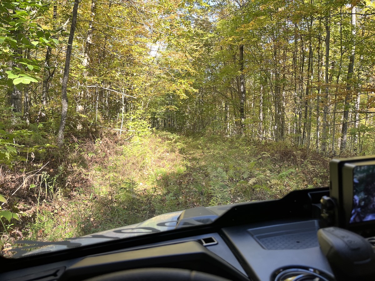
Good hiking conditions, especially on the mowed trails (see below). Unmowed trails have tall grasses (knee high or taller).
Insect activity is mild-moderate. Anticipate some nasty deer flies; ticks have been numerous this year.
IMPORTANT UPDATES
snowfall
May 7: scant flurries
grooming & MOWING
Mowing Report / Plans:
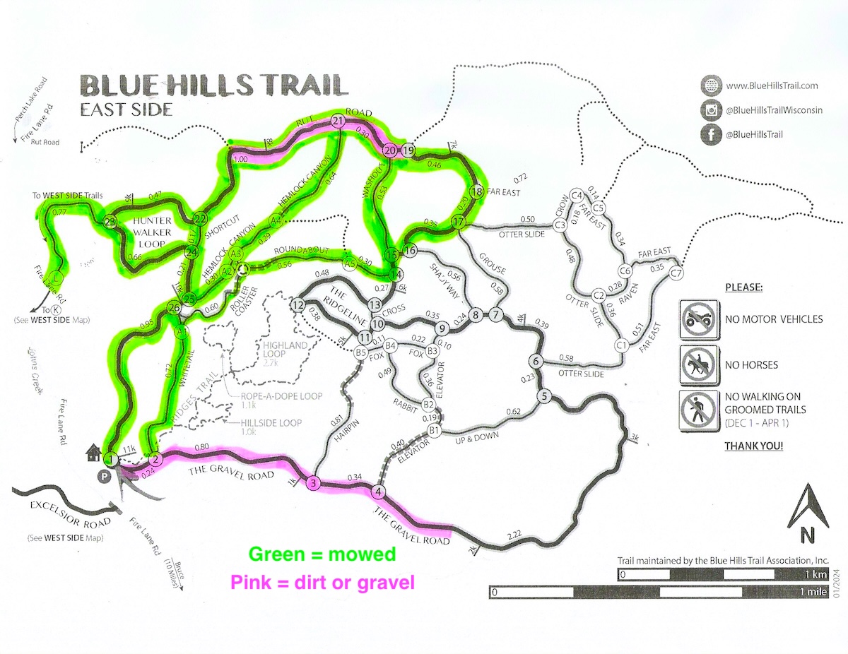
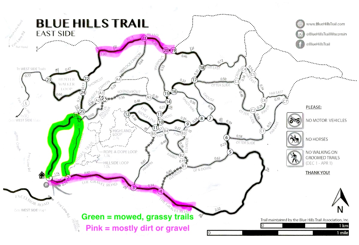
Mowing of the East Side trails began June 27th - look at the mowing map (below). The Rusk County Forestry Department usually mows the West Side trails in late August or September.
Most recent mowing was July 14th - check back for updates.
weather forecast

trail work
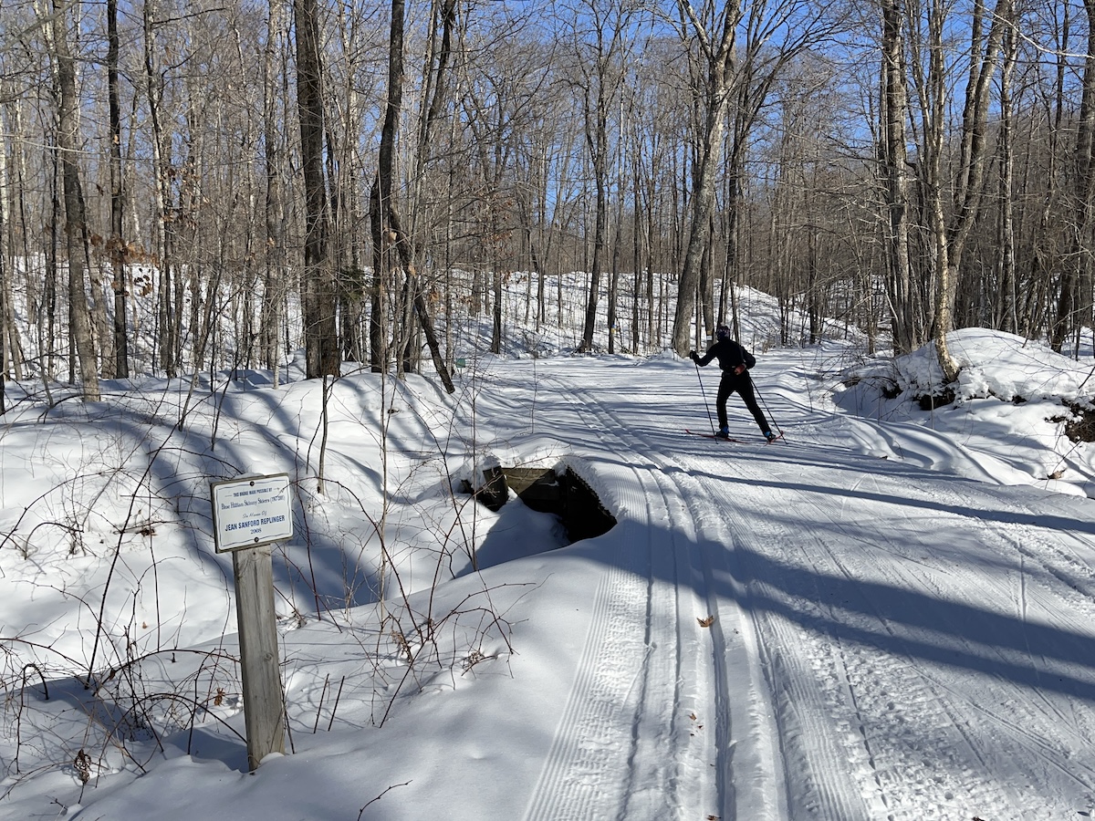
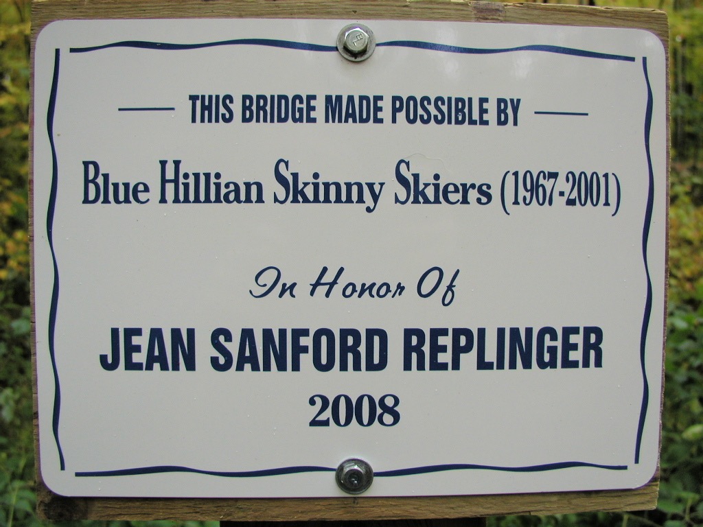
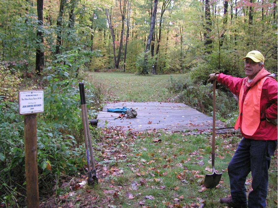
50-60 years ago, Jean Replinger and her friends enjoyed skiing the trails that eventually became the Blue Hills Trail. Recently the Blue Hills Trail Association received a generous donation from the Jean Sanford Replinger Foundation in her memory.
Jean passed away in November 2024 at the age of 96. Her decades-long connection to the Blue Hills Trail was just one of her many outdoor passions – her memory serves as a tremendous inspiration to her numerous friends and family, and anyone who knew of her.
Read the following message (in italics) from the Jean Sanford Replinger Trust:
Jean was a lifelong outdoor enthusiast and educator. Born in Ladysmith, WI, and a graduate of UW Madison, Jean was committed to using the outdoor experience to spark curiosity, discovery, learning and stewardship of the natural world, of human relationships, and the care of our communities through the values of diversity, equity and inclusion.
It was while teaching at Antioch College in Ohio (1950-67) that Jean began the tradition of an annual weeklong ski trip to the Blue Hills in northwest Wisconsin. Students, coworkers and friends were invited, experienced skiers and novices alike. This tradition continued after Jean and her husband, Randy, and son, Eric, moved to Marshall MN, where Jean was a professor of outdoor education (1969-96).
We are pleased to be able to make this contribution to the Blue Hills Trail Association knowing that it will go toward helping to keep trails accessible and in good condition so that all who are interested are able to experience the delight and rejuvenation that a good ski experience provides.
To learn more of Jean’s background, her love of silent sports, and to appreciate one person’s ability to favorably impact their world, visit this link to her beautiful obituary: https://www.hamiltonfh.com/obituaries/jean-replinger
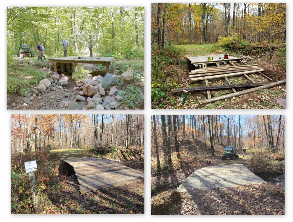
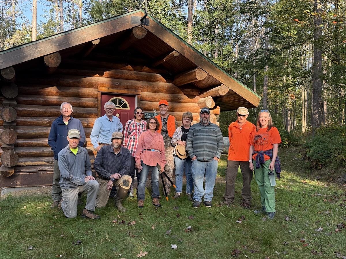
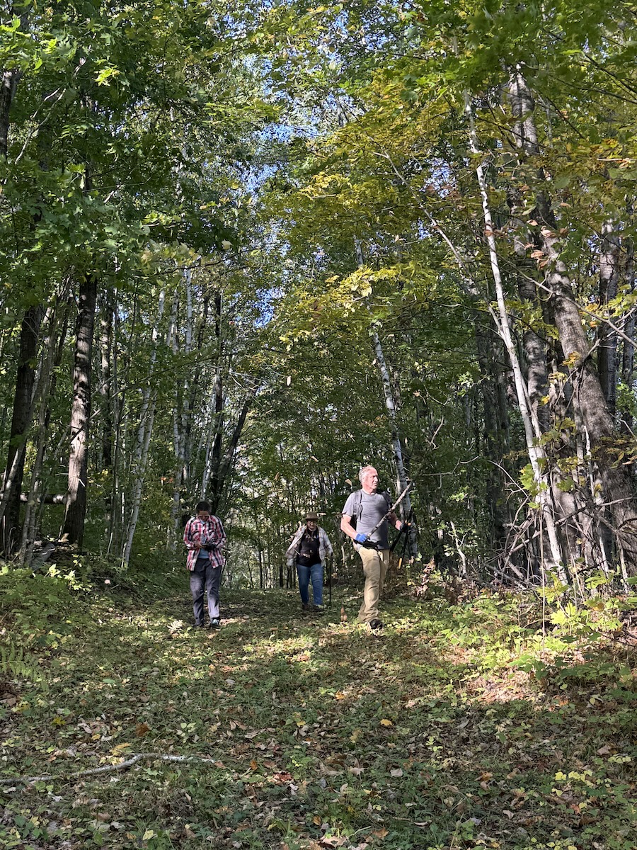
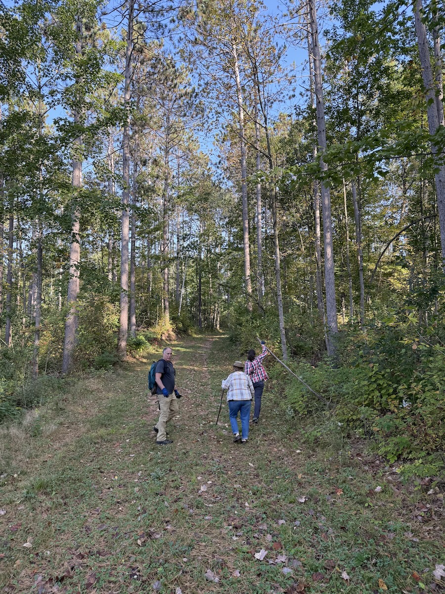
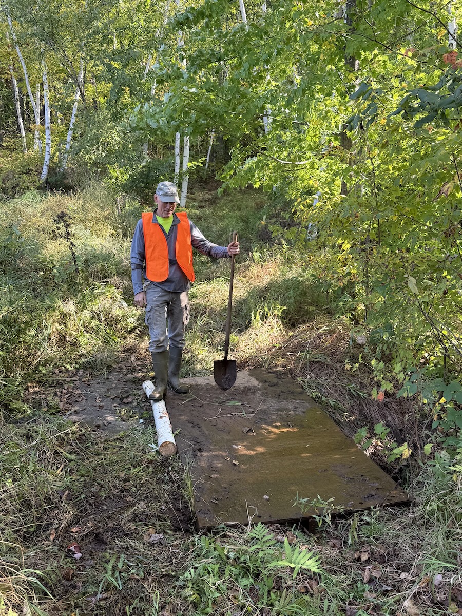
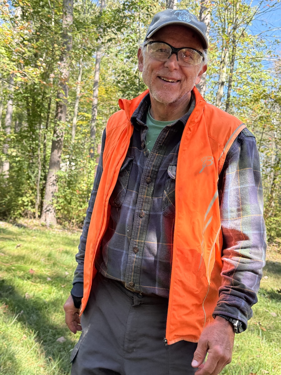
Thanks to everybody that helped during our annual Work Day on September 27th!
Here's a list of our eager volunteers : Heidi A, Rose A, Carolyn C, Dominic H, Jan P, Tom P, Geary S, Bob L, Bill R, John W, Kevin W, Amanda W, Bob W, and John Z.
We enjoyed gorgeous weather and good fall colors as we picked rocks, threw branches, removed logs -- generally getting the trails ready for our favorite time of the year: winter x-country skiing! We probably totaled about 50 human-hours of labor and camaraderie.
If you weren't able to help on the designated work day, we have some leftovers for you. When out hiking this fall -- feel free to throw a few rocks off the trail, perhaps clip some encroaching branches, and remove new windfalls. Please contact our website if you find tree falls that need chainsaw removal.
The Blue Hills Trail Association (BHTA) started our summer trail mowing on June 18th. The map (below) shows the trails mowed as of June 18th. Mowing is accomplished in stages during the months of June/July/August. For an updated mowing report and map, visit our website and click on the 'Trail Conditions' link at the top of the page, then scroll down to the 'Mowing Report'.
Background Details:
- We have 22+ miles of trail that need mowing.
- Our crew of mowing volunteers usually mows a total of about 50 hours each summer.
- Prior to 2003, the Rusk County Forestry Department mowed the entire trail system. They were using a tractor with a deck mower -- and the tractor often created deep ruts that negatively impacted the goal of a smooth trail surface.
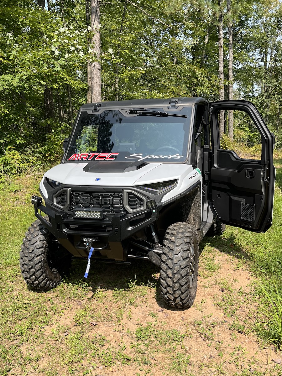
- In 2003, we (BHTA) purchased a trail mower to be towed behind an ATV so we could mow the softer trail segments. Even that was less than ideal, still leaving tire ruts that later needed repair.
- In 2014, we switched to mowing using a John Deere Gator on tracks. That's when we organized a trail crew to handle the mowing. Using tracks on the soft trail segments has greatly improved the trail surface when it's time to start wintertime grooming for skiing.
- At this time, the Rusk County Forestry Department mows the driest trail segments with their heavier equipment, this amounts to about 1/4 of the trails.
- The Blue Hills Trail Assn mows the remaining 3/4 of the trails using our 2020 Honda Pioneer (with tracks) pulling our AcrEase Trail Mower that cuts a 57" width.
- The 2003 mower was replaced in 2012 with an updated model; and in 2021 we replaced the 2012 engine with an upgraded Briggs & Stratton engine that is working well.
- Mowing typically begins in late June, and our goal is to complete the bulk of the mowing by mid August.


The Year That Was (2022-2023):
At our annual fundraising banquet (November 4, 2023) our 'State of the Trails' summary was a year to review our recovery from a devastating December 2022 ice storm:
Ice storm, record snowfall, and equipment issues – what an incredible challenge!
- November 2022 we graveled the first 200 feet inside the gate at the warming house. This did away with an area that had been perpetually muddy and limited access to our equipment in all but very dry conditions. November snowfall = 12".
- December 2022 early snowfalls were encouraging. We were able to groom & ski the new trail on the West Side once before the mid-December ice storm (ice + 16" of heavy tree crushing snow) devastated the trails. It took about a week to open the access road to the trailhead. Then we rented heavy equipment and operated it for 3 days at a cost of about $7000. This opened up a shortened version of the East Side Core Loop and our groomers created good skiing. When almost done with the rental equipment, the cab of the backhoe was slammed by a tree with damage that totaled out the backhoe – fortunately we had purchased short term insurance that covered the damage. December snowfall = 28".
- In early January a group of our volunteers worked in deep snow to clear another important section of the East Side trail. The snow kept coming, temps were mild, we kept grooming and enjoyed good skiing on the limited number of open trails. In mid January, the forestry department hired heavy equipment to open Excelsior Road on the West Side, then we groomed it and enjoyed it. The rest of the West Side had too much ice storm damage to open more trails. In late January, our Honda UTV acted up by mysteriously shattering its fan blade – a quick trip to the shop in Rice Lake fixed that problem. January snowfall = 16".
- February skiing conditions remained very good with mild temps and timely snowfalls. In mid-February, a team of our volunteers worked in deep snow to remove ice storm damage from the East Side ‘Washout Trail’. This created a connection with Rut Road that included more of the Core Loop. Meanwhile, John Kann worked overtime to add two new snowshoe loops that were well tromped. Hats off to John Kann! Our 2017 Arctic Cat Bearcat Groomers’ Special snowmobile is a big workhorse, powerful and maneuverable. It nicely complements the Honda Pioneer. Unfortunately, the Bearcat overheated on multiple occasions the past two winters, presenting a diagnostic challenge that we finally solved in February. A $4 fuse (a circuit breaker fuse) was the culprit! February snowfall = 13".
- March remained snowy, and we kept on grooming. In early March, the rear tracks on the Honda showed signs of failing rubber – perhaps due to the incredibly hard work required to groom the chunky condensed snow after the heavy equipment operated in December. We ordered replacement rubber tracks, and the day after the new tracks arrived the left rear track ‘failed’ and we replaced the rubber track in the parking lot. Truly a wrestling match replacing that track! Even though we still had a deep base, because the forecast showed warmup & rain, we decided to move grooming equipment to storage after the final grooming on March 20th. In late March, good crust skiing was available throughout! March snowfall = 20".
- April 1st delivered 12" of dense snow in the form of a blizzard! Then a week later, good crust skiing was available again. The next surprise? Ttemps soared into the 80s for 5 days, followed by 3" of heavy snow, followed by 1.5" of rain that melted most of the remaining snow. In late April we assembled a work crew to remove the mess of damaged trees around the warming house. April snowfall = 15".
- Total snowfall for the winter set a record for the 25 years we’ve kept records: 104 inches! The previous record was 89 inches during the winter of 2013-14.
- During the first half of May, on four occasions we assembled work crews and cleared more of the ice damaged trees. At that point, thick clouds of mosquitoes and gnats chased us out of the woods. In late May we were also able to install large vents in the storage container where our snowmobile sleeps – hopefully this will reduce the potential of condensation & moisture damage to its electronics (recall the corroded circuit breaker fuse?)
- In late June, we began our summer trail mowing. However, during hot weather, the Honda UTV developed several problems that were likely related to a faulty speed sensor. During the month that it took for the repair, trail work was on hold.
- In July and August, we hired a crew from the Flambeau Correctional Center to help clear ice storm damaged trees. They did a fantastic job clearing many of the West Side trails, and several East Side trails. Money ($2000) well spent! Another oddity this summer was the heavy growth of burdock – thick forests of burdock 6 feet tall.
- As the bugs became tolerable in late July, our own volunteers again worked to remove damaged trees on several more occasions. By September 1st, the entire trail system was (mostly) clear of the ice damage. All told, probably more than 3500 damaged trees – about 100 trees per kilometer – were removed from our 35 km of trails.
- Our annual fall workday on October 1st was lightly attended on a day with temps in the upper 80s. Despite the heat, a lot of important trail work was accomplished that day.
- Despite a dry, hot summer, the fall colors were very good and hung on longer than usual.
- What A Year!!! Many thanks to all our volunteers & donors – the trails are now in great shape for winter.
Here are some specific thank yous…
- Thanks to everyone attending our fundraising banquet, and to everyone that helped with trail work this past year. Your support in the form of donated time and money makes it all possible.
- Thanks to our volunteers for removing downed trees & their 45+ hours of mowing this past summer. An incredible team effort!
- Thanks to John Waldron & Geary Searfoss for serving as officers. They bring boundless energy and wonderfully creative ideas. World’s best volunteers!
- Thanks to last year’s grooming team for creating great skiing conditions despite the incredible challenges resulting from the ice storm.
- Thanks to Jan Paulsen for photos from the banquet, and for decorating the banquet site. Leaves, acorns etc from a recent hike on the ski trails.
- Thanks to Kirk Paulsen for donating his engineering skills in designing the new trail maps several years ago, and for updating them as the trails evolve. His maps are highly accurate & informative. NOTE: thanks to Kirk’s engineering tech skills, you can visit our website & easily place our maps on your phone for use with the App called Avenza Maps. You’ll be able to take advantage of satellites to follow your location in real time. Very useful.
- Thanks to Kristine Paulsen for her ongoing involvement with our website – what a great portal she has provided us!!
- Thanks to John Kann & Dan Bjugstad who continue maintaining our network of dedicated snowshoe trails – after the December 2022 ice storm, John almost single handedly opened two new loops through the downed trees.
- Thanks to the Rusk County Forestry department for mowing most of the West Side, and parts of the East Side. With them, we have a great partnership maintaining the Blue Hills Trail.
- The distant loop on the West Side (C-D-F-G-H-I) remains beaver territory. For now, we think we can coexist and avoid removing the beavers. In fact, their two active dams undoubtedly help control runoff during heavy rain events – thus minimizing erosion of the ski trail. Because that loop is so difficult to groom – and because we now have more & better trails on the West Side – that loop will receive minimal grooming and be considered a wilderness loop. We’ll groom it if/when conditions permit.
- The big timber sale that was cut last fall on the Far East Trails still has lots of wood (400 cords of wood = 40 truckloads) that needs hauling. Markets for hardwood pulp logs have been poor this year – the loggers will try more hauling in November 2023 if they can find a market. The loggers realize we plan on grooming in early-mid December and should be done using Rut Road (part of our East Side Core Loop) by that time.
- One West Side timber sale was cut during June, a clear cut where the new trail (between intersections Y to Z) joins Excelsior Road. It’s already growing back quickly, don’t let its appearance shock you.
- The trail system has two timber sales that have been bid out and await logging – one on the East, one on the West.
- Remember, the entire trail system is non-motorized. If you find motorized vehicles on the trails, educate their operators to the contrary. And consider reporting this to the Rusk County Sheriff’s department.
Equipment and Monies:
Thanks for your financial support. Despite the unanticipated large amount of money spent this past year on clearing ice storm debris (approaching $10,000), we're in good shape financially, and the equipment is running well. If you'd like to send a donation our way, follow this link.
Whenever you can, please thank the many businesses and individuals that support the Blue Hills Trail Association Inc.


After the December 2022 ice storm brought down an incredible number of trees throughout our 20+ miles of trails, spring of 2023 our officers weren't confident we'd be able to remove all the damage before the winter of 2023-24. At best, we hoped to clear the damage from our favorite trails. But guess what? As of September 1st 2023, 100% of the trail system has been cleared of downed and leaning trees. Amazing! Amazing!! Amazing!!!
Here's a time capsule of the removal of the storm damage...
- Late December we spent close to $7500 when we rented and operated heavy equipment (backhoe and skidsteer) to clear about 40% of the East Side Trails. Good skiing followed.
- Early January the Rusk Forestry Department contracted removal of downed trees from Excelsior Road on the West Side. And we thoroughly enjoyed skiing that segment.
- January/February BHTA volunteers (Blue Hills Trail Assn) spent several days clearing a few important trails on the East Side. Really tough work removing ice encrusted tree tops buried in 2+ feet of snow.
- We enjoyed some mighty fine skiing on the open trails -- and enjoyed the overall record snowfall and winter that wouldn't quit.
- In May, our volunteers provided 4 separate sessions of tree removal that buoyed our spirits. Then the bugs moved in.
- During June/July/August, we hired an affordable work crew from the Flambeau Correctional Center to clear most of the West Side trails, and several important loops on the East Side. They worked 7 full days for us! And did a great job in prepping for winter (removing not only the downed trees, but also the leaners that would block the trails when snow loaded).
- Once the bugs backed off in August, we organized several mornings for our volunteers to continue chainsaw work on the East Side. The last session was August 30th as we cleared the 'Far East' trails.
I think this is a fair estimate of the degree of damage we dealt with this past 9 months: 100 trees removed per km, 10 trees removed each 100 meters. That's an average, some areas weren't too bad, other areas were an unbelievable tangled mess. We removed many small trees, many medium size trees, occasional very big trees. For our 35+ km of non-motorized trails, that amounts to 3500 trees cleared to make way for our hunters, bikers, snowshoers, and skiers.
In between sessions to clear trees, we've found time to mow most of the East Side of the trail system. Those trails are in great shape, just in time for fall weather. The Rusk County Forestry Department is handling most of the mowing of the West Side - hopefully that mowing will soon start.
When you ski the Blue Hills Trail this winter, pause and reflect on not only the beauty, but the work involved. If you'd like to help us financially, here's the link where you can donate.
Happy Labor Day!


In mid December 2022, a destructive ice storm spread an unbelievable amount of damage throughout our trail system - and throughout the surrounding counties. After the deep snow pack finally melted, on April 26th we had a crew of 7 rough & tough workers clean up the ice storm debris at the trailhead around the warming house and pit toilets. They turned an unsightly mess into organized chaos. The grounds looked much more inviting after the work was completed. Once again, the warming house welcomes you.
A HUGE THANK YOU! to... Sam Behrends, Shelly Grendahl, Jan Paulsen, Tom Paulsen, Jerry Schneider, John Waldron, & Kevin Westlund.
Click here for an Instagram Post where Jan captured the action in a music video.
We have plenty more ice storm damage throughout the trail system, and will ask for your help later this summer and fall. Please consider lending a hand. Everyone is welcome.


Cleanup crew at work...


After the cleanup...


The past couple weeks, John Kann (our Snowshoe Superman) has been busy laying out a new snowshoe trail, and improving the existing Ridges Snowshoe Trail. Here are the details:
- First he added more ropes to the existing northwest loop of the Ridges Trail – human tow ropes – to help ascend/descend steep hillsides. With the addition of these ropes, he decided to name that trail segment the “Rope-A-Dope Loop". Find it on the map photo(s) below.
- Then John created a great new loop that branches off the existing Ridges Trail – it measures about 2 km in length, heads to the northeast, climbs to the east side ridgeline near intersection #12, then descends back to its origin. John named it the “Highland Loop". Look carefully at the images below.
- The snowshoe trails are marked with a variety of yellow symbols. To find your way, look for yellow snowshoe symbols, yellow signs, plastic yellow tags, or yellow paint on trees.
- Some time soon, our official map designer will add the Highland Loop to our online maps. Until then, go explore the woods and follow the yellow stick road.


Thanks to everybody that helped during our annual Work Day on October 1st!
Here's a list of our eager volunteers : Sam B, Carolyn C, Ron J, Jan P, Tom P, Kate P, Joel R, Geary S, Bob S, John W, Kevin W, Bob W, and John Z.
Intermittent light (somewhat unexpected) rain showers kept us cool as we picked rocks, threw branches, removed logs -- generally getting the trails ready for our favorite time of the year: winter x-country skiing! We probably totaled about 50 human-hours of labor while enjoying nice fall colors.
If you weren't able to help on the designated work day, we have some leftovers for you. Contact our secretary (Tom) via email (bluehillstrail@gmail.com) to see which trails will benefit from additional trail clearing. You are especially encouraged to visit the new trail on the West Side (between Y and Z) for an enjoyable hike -- feel free to throw a few rocks off the trail while you're at it. We're expecting this new trail to offer a great way to access the inner trails on the West Side, while challenging your degree of fitness (plenty of ups, downs, and rollers).
If out hiking the trails this fall, please contact our website if you find tree falls that need chainsaw removal.


Post Categories
Blue Hills Trail
instagram updates
Subscribe to Newsletter Updates
Stay in-the-know about grooming updates, special events, news, announcements, volunteer days, and more. Rest-assured, we never sell or share your information.
